Use APKPure App
Get Smart Tools old version APK for Android
Application Smart Tools pour voyager, faire de la randonnée et juste pour le plaisir!
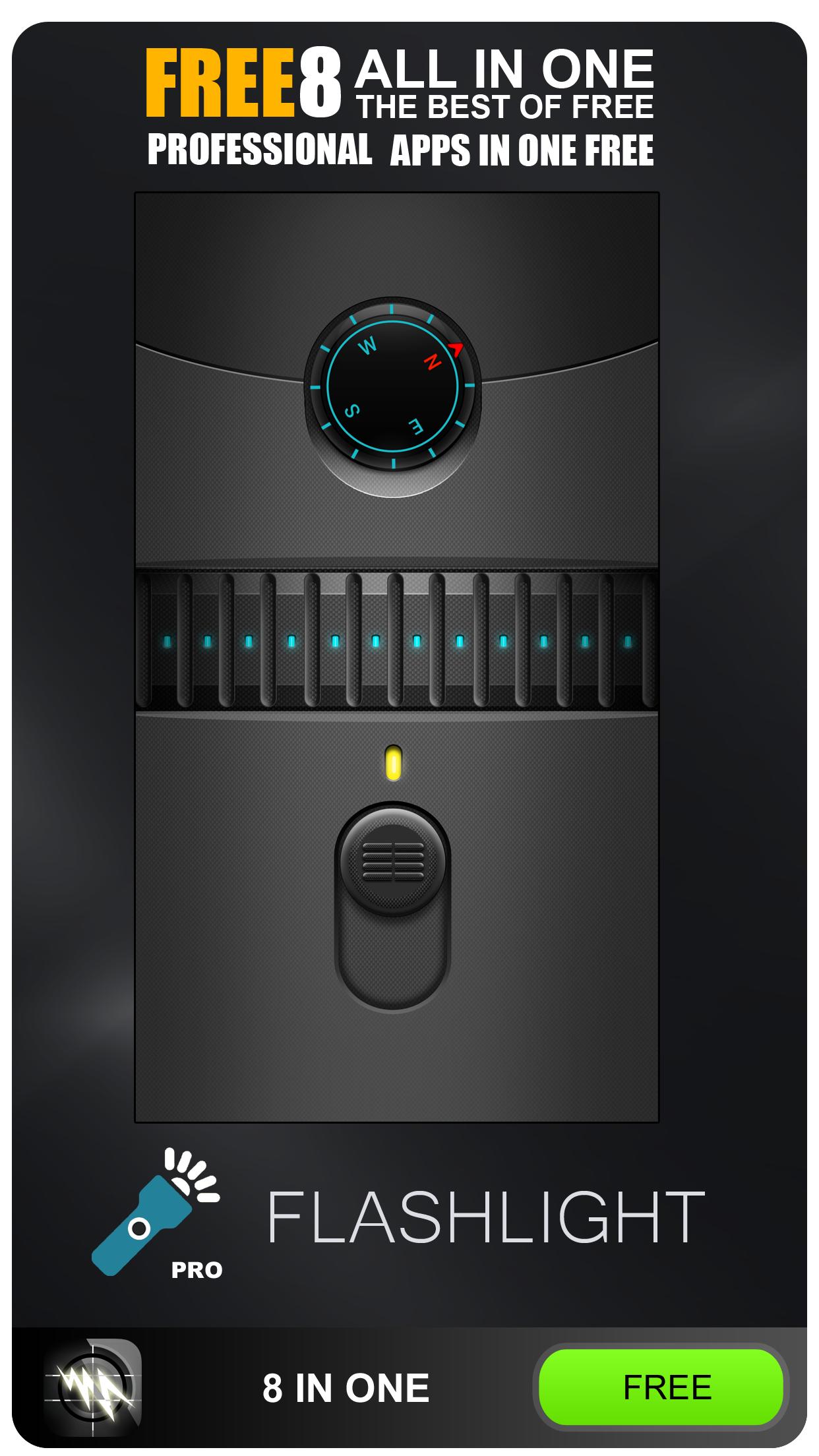
Smart Tools: All in One is 8 tools that you can use wherever you go in one bundle application.
1.Compass Pro
Compass Pro is the app for professionals as well as amateurs! Compass Pro is a real compass! It shows device real-time orientation to magnetic fields. It's displays lot of useful information like location, altitude, speed, magnetic field, barometric pressure, etc.
Compass Pro is easy to use. Following a particular bearing is easier too. Just tap on button to set a particular bearing and the app will then draw a red arc around the inside of the compass circle to indicate how far you’re deviating from your set course.
2. Speedometer GPS SPEED LIMIT ALERT SYSTEM
This application is a GPS-based most accurate (we create speedometers since 2010) - Switch between car speedometer and bike cyclometer. - High low speed limit alert system - HUD Mode Switch between mph or km/h mode. - Imperial and Metric unit settings. - Speed calibrate refresh button. - GPS accuracy indicator. - GPS distance accuracy indicator. Track information - Start time. - Time elapsed. - Distance. - Average speed. - Max speed. - Altitude. - Time tracking. - Tracking location on map. - Ability to turn tracking off/on. - Longitude, latitude coordinates. Map integration - Satellite maps mode. - Hybrid maps mode. - Standard maps mode. - Tracking location changes trajectory. Share - Start, end points, coordinates link email sending - Map screenshot email sending .Weather - Temperature information. - Wind - Visibility - Sunrise,Sunset - High/Low Temperature.
3. ZOOM Camera
Zoom Camera will let you take the best photographs and videos, taking maximum advantage of your phone.
4. Altimeter GPS+
Modern Altimeter GPS+ app is for folks who care for hiking and biking in mountainous terrain. GPS is getting very accurate in terms of distance indication. The choice between unit system is perhaps an important thing, just for your convenience the app is being equipped with both of them (Imperial and Metric). This app has a creative and user-friendly style design, simple and comprehensive functionalities. Features included Take photos with your current location info ,Search any place and drop search pin with place info.Built in library Map integration. Compass. Track information. Tracking. Weather .
5. Magnifier
This app turns your phone into a functional and easy to use magnifier.
6. Flashlight
Free LED torch Flashlight for your Phone..
7.Night Mode Camera (Photo & Video)
Fast and Simple app for taking bright images and videos. While your photo flesh is unable to light the exotic beauty of nature, or moon and stars high in the skies, or beautiful sea waves, or flowers at night: Night Mode Camera is ready to do that at the lowest luminosity without any additional appliances. With low light support during the photo/video recording, you can dynamically change camera sensitivity to achieve the best result as well as set any 1-8x zoom simultaneous to the recording due to the professional development. The app not only allows you to keep and organize your own library but as well to share them on Facebook, Instagram, Twitter and basically everywhere, where you would prefer.
8. GPS Location Info, SMS Coordinates
GPS Locations shows your current location, date & time to the second along with a scrollable map. You can copy your coordinates & locate anything you can find on the map with accurate crosshairs.
Have a telescope that needs your coordinates & the current time? Need to know the coordinates for your hunting stand? Going on a trek and need to find your lat/long? Want to scroll around the world and see where your favorite landmarks are? GPS Locations is what you need.
After launch, the map automatically centers on your location. Elevation is shown feet & meters. Your phone's time is shown in Greenwich Mean Time (aka Zulu time). To recenter the map on your location, just hit the crosshairs button.
Dernière version
![]() 1.0
1.0
Telechargé par
Sahasawat Mono
Nécessite Android
Android 4.1+
Catégories
Signaler
Last updated on Mar 5, 2020
Minor bug fixes and improvements. Install or update to the newest version to check it out!


Discover what you want easier, faster and safer.


![Comment télécharger la dernière version de Google Play Store APK 42.0.20-23 [0] [PR] 654119317 pour Android 2024](https://image.winudf.com/v2/image/YWRtaW5fR29vZ2xlLVBsYXktU3RvcmUtNi4xLjEyLUFQSy5wbmdfMTUxMzA2Nzg1ODQzOQ/banner.jpg?fakeurl=1&w=192)


Smart Tools
8 PRO APPS IN ONE BEST1.0 by DODOS
Mar 5, 2020